For my usual Toussaint (All Hollows) trip, I chose like last year to go to Italy. This time I targeted the 12 BIG between Chiavenna and Ornavasso (11 in Italy and 1 in Switzerland). I would have added with pleasure Passo San Marco and Val Malenco to my program but as I wanted to be back in Nice for the Nice-Nantes football match, I had no time for them.
As I did several times before, I woke up at 2 am (it’s early) to catch the 5 am train from Ventimiglia to Milano. I chose to start with the Menarola climb so headed to Chiavenna. In fact I wanted to stop at the station before, but as it was quite a long name (Prata Camportaccio) I couldn’t remember it and took instead a ticket to the simpler Chiavenna. From Milano one has to take the train towards Tirano then change in Colico.
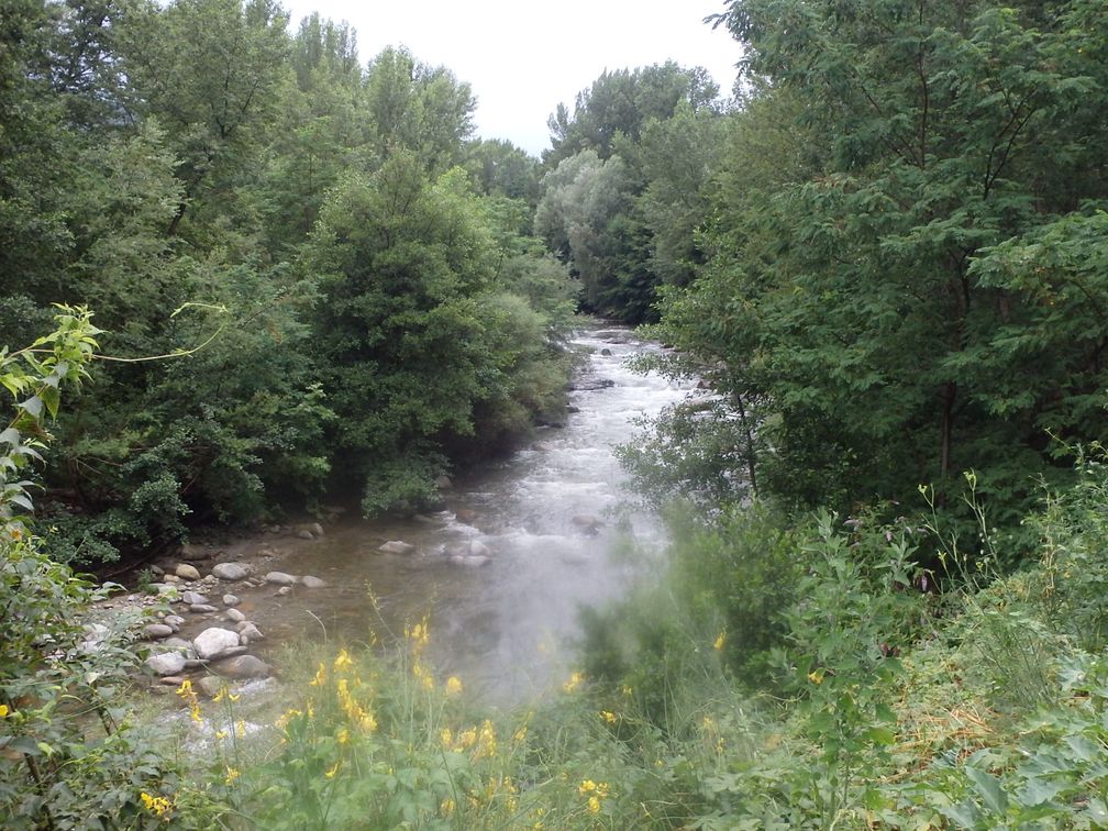
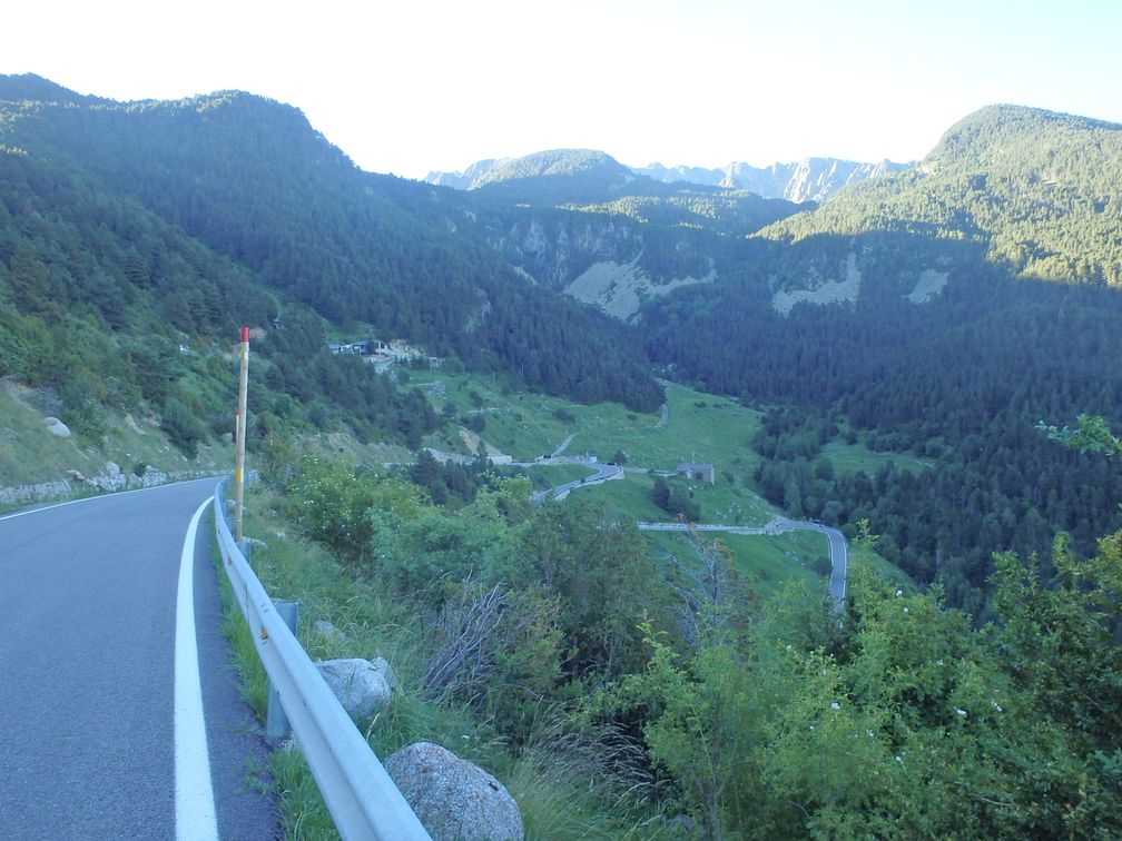
I discovered in Colico that, due to works on the line, the train didn’t go further than Novate-Mezzola. So I began my bike ride a little sooner than expected. After a few kilometres on the busy valley road, I saw on my left a nice cycling path, along the Mera River. In Ponte Nave there was a bridge crossing the river so I quit the cycling path as I knew Menarola was on the right bank. But another bridge 3 kilometres further took me back to the same cycling path. I finally found the good bridge to reach Gordona and the start of Menarola climb.
As I climbed this tiny road in the forest, I was confronted in some parts to carpets of fallen leaves, a feature that would follow me the entire trip. Thanks to my 25 mm Pro3 tires (no advertising, but I found they performed extremely well), I was not too bothered by that (with one exception, we’ll see later).
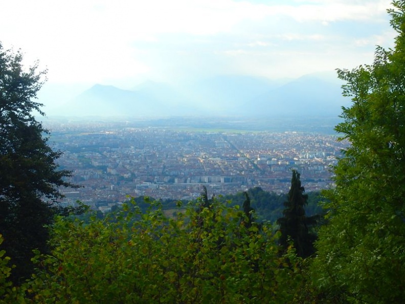
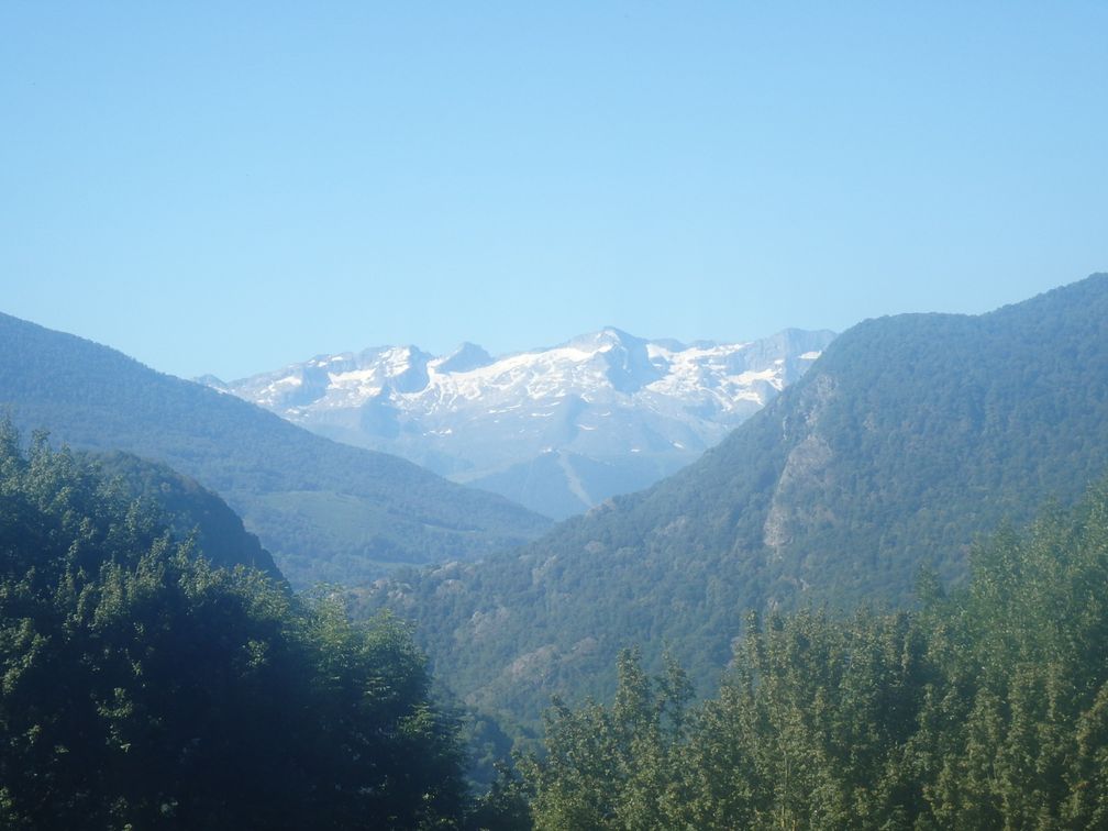
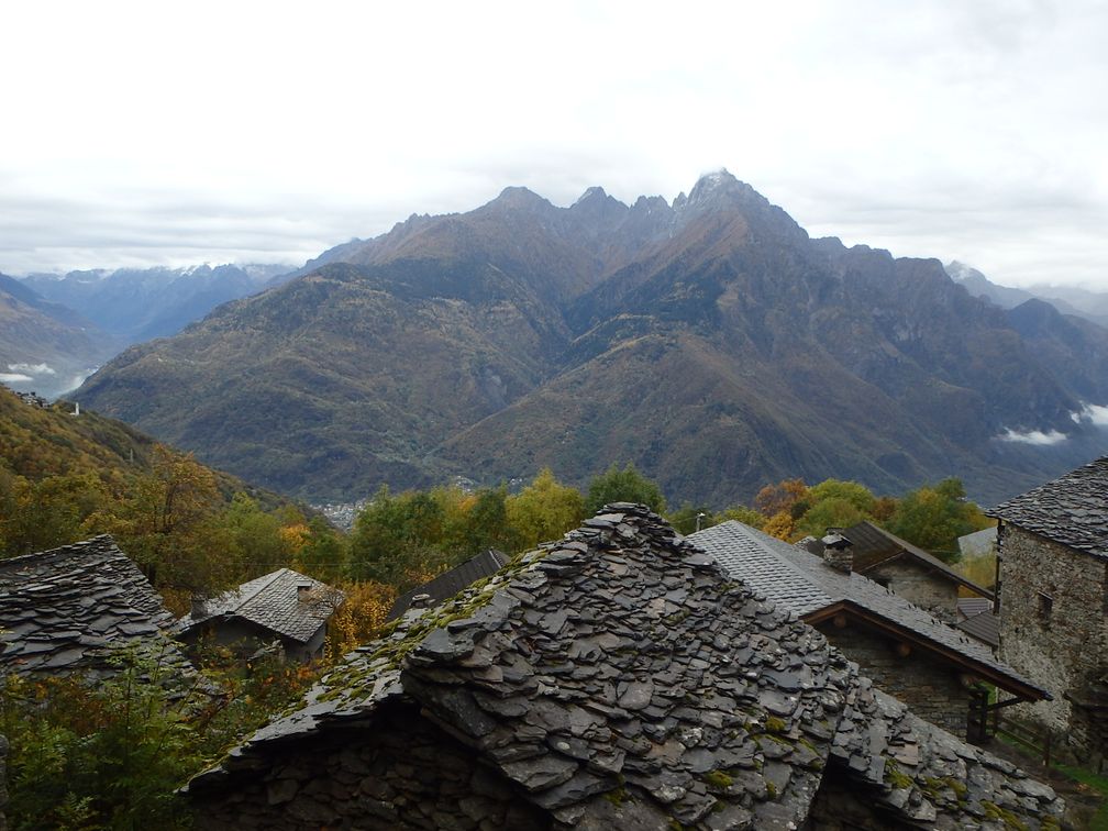
During the climb, I could enjoy some nice views over Valchiavenna, the valley that leads to lago di Como, and Val Bregaglia, the one going east towards Maloja pass and Sankt Moritz. After having passed the houses of Voga, I finally arrived at some lonely houses in a curve, where the asphalt stops. I continued for 400 m and arrived at a pylon where I stopped, as the track in front of me seemed to get “wilder”. Further investigation back at home showed me that I was just 150 m away from the end of the road, so it would have been maybe a better place for a finish.
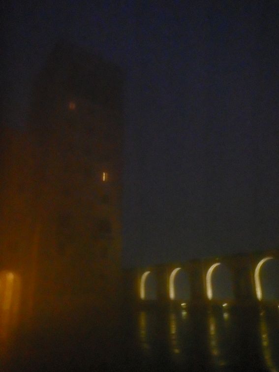
 Down in the valley, I stayed on the bike path all the way this time, down to lago di Mezzola where it finished. In Colico I stopped for a snack. When I got out of the bar, the rain started, and was to continue all the rest of the day. I followed the road along the north-east shore of lago di Como, and turned left in Dervio to climb Monte Legnoncino. In Tremenico, the place where the dead-end road to Monte Legnoncino leaves the Valvarrone road, a hotel was indicated. As it was still raining and night was arriving, I asked for a room but I was told at the bar that the hotel was closed. So I had no choice but to keep on climbing.
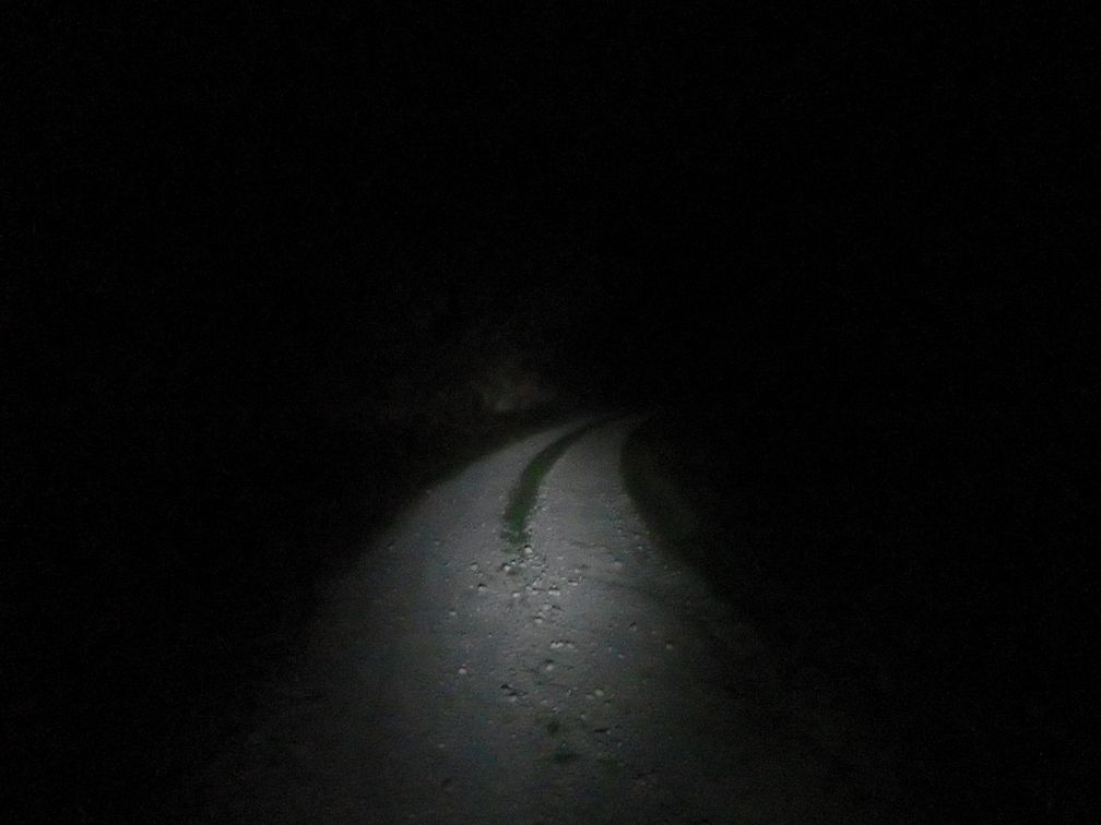
It was some kind of horrible climb, in the night, under the rain. The wet pine needles kept on gathering in my brakes, so regularly I had to stop to take them off. I finally arrived at some car park, with big stones on the ground. My GPS showed me the road was continuing, but it turned to be a forest track. Unaware of where the BIG was set, I wanted to follow the track to its end, but renounced quickly. Riding in the dark, under the rain, and on a non-asphalted track was too much for me, so I turned back and started to go down, whether I had completed the BIG or not (I was happy to find later that I had reached the official top, at the end of the asphalt).
I have planned initially, after Monte Legnoncino, to continue in the valley, turning back in Valsàssina through sella de Piazzo, to reach the foot of next BIG, Croce di Muggio. But it was night, it was raining, and I doubted much finding a hotel in the upper part of the valleys, so I turned down to the lake. In Dervio and Bellano I saw no hotel so continued to Varenna where there was a lot.
 The morning after the weather was fine as I was back in Bellano to climb croce di Muggio (in fact it is the official side of the BIG challenge). The road finishes in a little ski resort, Alpe Giumello. There’s a village with some houses but nothing after. I then went back to Varenna to take the boat to Bellagio. This is a very convenient crossing for BIGgers who want to climb Madonna del Ghisallo.
In Civenna I was fooled some instants, as the place looks very similar to Madonna del Ghisallo (for someone who’s never been there), overlooking the Lecco branch of Lago di Como. But as the chapel was devoted to hunters and not cyclists, I realized it was not the good place. Finally I reached the top, with everything I expected: the cyclists’ monument and the chapel (unfortunately, there was someone working inside and he had closed the door to public). At the top I talked briefly with a cyclist that told me it was its 99th climb of the year, and he expected the 100th for the next Sunday. A quadruple godfather of Madonna del Ghisallo, I should have enrolled him for the BIG challenge!
After a short descent, I started the ascent to Colma de Sormano. I had the intention to climb the Muro de Sormano, even if I feared it, as it is renowned to be so steep. But as I said, we were in autumn, and there were more fallen leaves here than anywhere else. On a slope up to 10°, it was not a problem, but with the muro di Sormano gradients, and the amount of wet leaves on the ground, it was impossible. I walked up to the next switchback but discovered a road completely hidden under the leaves. So I turned back to the main road, which is rather steep itself, and reached the pass without problems.
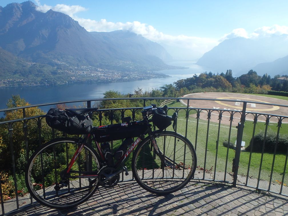
At the end of the descent, I was back at the lake, on the shore between Bellagio and Como. This road is nice, overlooking the lake with little ups and downs, and much less traffic than I had feared. From Como to Cernobbio it was much busier until I reach the Monte Bisbino road. Beautiful views of the lake and the city of Como are offered at the beginning of the climb, and unlike all of the other BIG of the region, Monte Bisbino is reasonably steep, so it was a nice climb. I headed then to Switzerland and Mendrisio, where I stopped for the night, at the foot of Monte Generoso.
Monte Generoso climb begins in a very steep street of Mendrisio, calms down when crossing some houses, then climbs steadily to the finish. There is a train going up the mountain but not functioning as I was there as a new hotel at the top was being built. The road ends at a stop called Stazione Bellavista, but I was not able to confirm that, as a thick fog surrounded me, and I unfortunately saw nothing of the supposed nice views over Lago di Lugano.
Down in Mendrisio, I turned towards Varese and entered Italy again. I passed along the north of Varese, and some very small roads around Olona, to go to my next BIG, Campo dei Fiori. A huge building, which is in fact an abandoned hotel, can be seen on the top when climbing. But the BIG is set at the observatory nearby, on top of a very very steep ramp. When going down, I thought about go and see the hotel, but was not sure of the way as two roads leave the observatory road in two different hairpins, so I continued my descent directly.
After Campo dei Fiori, I took the direction of San Martino, which is also a dead-end road that leads to a solitary chapel. During the climb, and also at the top, I could enjoy nice views to the Valcuvia below. There were children plays, and also a restaurant up there, but on a week day at the end of October, everything was desert.
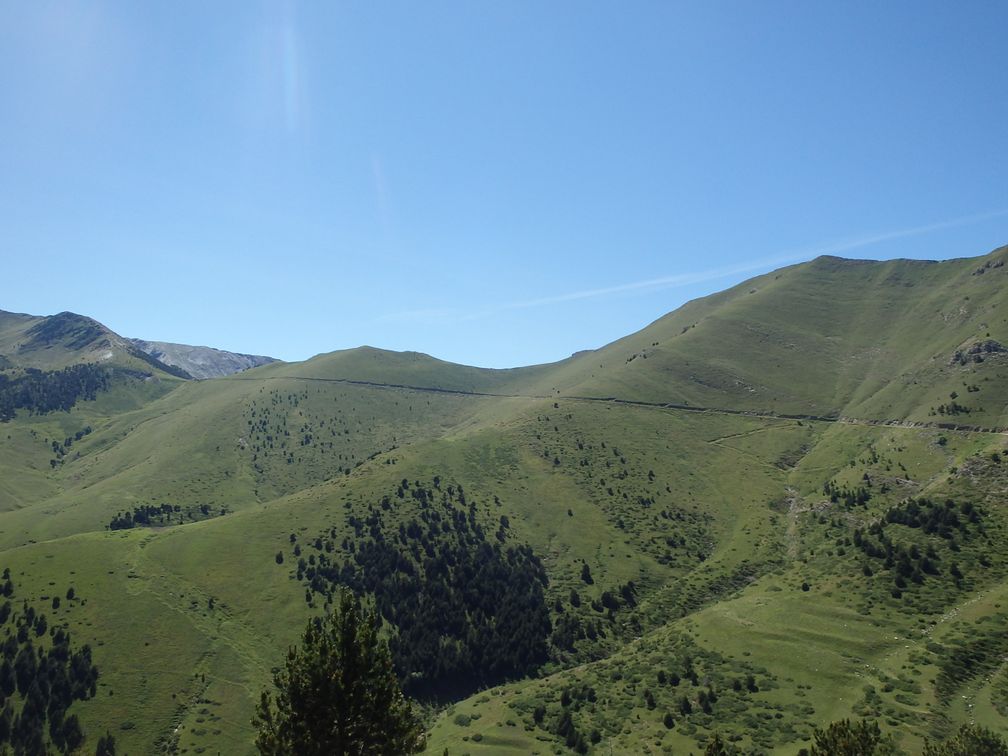
Down in Valcuvia, I had not a long ride to be at the foot of passo Cuvignone. In fact from this side, you climb north to passo Sant Antonio, where, instead of going down to lago Maggiore, you turn left to go to passo Cuvignone, which takes you back to Valcuvia again. It’s a steady climb all the way, and the descent towards Cittiglio appeared to me quite steep also.
I took once again a boat in Laveno to cross lago Maggiore, as the last two BIG, Alpe Rossombolmo and Mottarone, were on the Piemontese side. I stopped when I saw a hotel in Mergozzo, along a nice lake, just before Ornavasso, the foot of Alpe Rossombolmo. It was not very late when I arrived, so I was thinking of climbing Alpe Rossombolmo in the evening, after having set up in the hotel. But I feared this climb, and riding at night is nice in a way, but of course hides the scenery, which is the main motivation for this kind of trips. So when the man at the hotel locked my bike in his garage, I let him do without protesting.
The morning after, I headed towards Ornavasso under a generous sun. At the Santuario Della Madonna Del Boden I felt something strange about the road, and realized I should have turned right just before. After a few kilometers on a steep road, the asphalt began to deteriorate, and the road became so steep at a moment that I couldn’t no more stay on my bike. After a flat stretch in the forest, and another impossible to ride steep ramp, I arrived at a wooden arch that showed the beginning of the path to Alpe Cortevecchio. From this point, the road was all rideable, even if there were still very steep ramps, and I arrived finally at the top of the climb.

The road finishes abruptly a few hundred meters before what appears as the last house in this part of the mountain. From here you can see a little below the few houses of Alpe Cortevecchio, and in the distance Isola Madre in the middle of Lago Maggiore. I have read, but after my ride, that walking to the crest just over the road would have allowed me to discover wonderful views of the Ornavasso valley below.
After a cautious descent, I was on the highway towards Gravellona Toce and Omegna. At the south exit of Omegna, I took the Mottarone road. As this road climbs along the lago d’Orta, I expected nice views over the lake but it was hidden most of the time by a wall of trees. After Agrano and a little descent, I climbed to Armeno where I took a one-way street (it’s bad) to save me 20 m of elevation loss before reaching the last part of the Mottarone road.

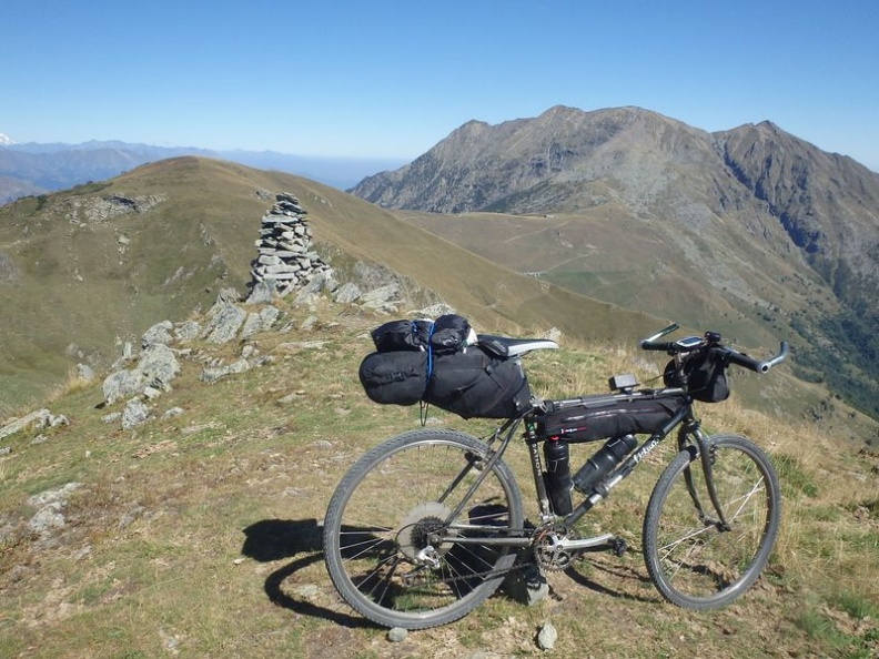
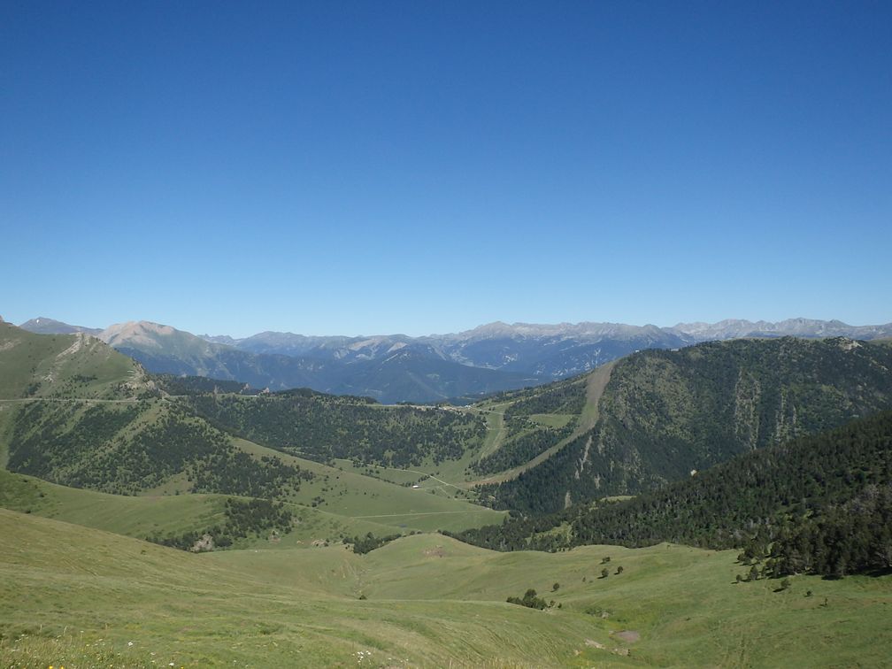
This was the last BIG of this four-day trip, but it turned to be by far the most beautiful, and one of the most (if not the most) extraordinary climbs I’ve ever done. On the first hairpin over Armeno, I began to see a snowy peak (Monte Rosa) rising over the lower, forest-covered, mounts around me. As I climbed, more mountains were showing in every direction. On a stretch looking south, I was even happy to see the familiar figure of Monviso, at a distance of 170 km!
The road from Armeno joins the road from Stresa for the last stretch to a little ski resort. There the road performs a loop around the peak and a cemented, deteriorated and very steep ramp allows to reach the top of the mountain, where stands a big antenna.

From here I enjoyed one of the most beautiful panoramas that can be found, with mountains everywhere: Monte Rosa, Breithorn, high peaks from Saastal, Bernina, and so on. Below could be seen all the lakes: Maggiore, Orta, Varese, Lugano … It was a splendor.
After a long stop and a lot of pictures taken, I started the descent towards Stresa. I passed a tollbooth that seemed strange here as the other road was free and arrived above Stresa, enjoying some last nice views over the town and the Borromee islands.
The trip was now finished and it was time to take the train back home. The Stresa line leads to Milano, where I was unlucky to miss a train to Genova for a few minutes. So I had to wait two hours for the next one that went to Albenga. I finally stopped in Genova, as I renounced to do the ride from Albenga to Nice from midnight to 3 am. When I found myself alone in my hotel room in Genova I thought I should have done it anyway, but never mind, the Sunday afternoon I was back in Nice to see my favorite team defeat 4 to 1 the FC Nantes, and with 12 more BIG in my musette.
Pictures : http://cathie.charbonnier.free.fr/piwigo/index.php?/category/7
As I did several times before, I woke up at 2 am (it’s early) to catch the 5 am train from Ventimiglia to Milano. I chose to start with the Menarola climb so headed to Chiavenna. In fact I wanted to stop at the station before, but as it was quite a long name (Prata Camportaccio) I couldn’t remember it and took instead a ticket to the simpler Chiavenna. From Milano one has to take the train towards Tirano then change in Colico.
I discovered in Colico that, due to works on the line, the train didn’t go further than Novate-Mezzola. So I began my bike ride a little sooner than expected. After a few kilometres on the busy valley road, I saw on my left a nice cycling path, along the Mera River. In Ponte Nave there was a bridge crossing the river so I quit the cycling path as I knew Menarola was on the right bank. But another bridge 3 kilometres further took me back to the same cycling path. I finally found the good bridge to reach Gordona and the start of Menarola climb.
As I climbed this tiny road in the forest, I was confronted in some parts to carpets of fallen leaves, a feature that would follow me the entire trip. Thanks to my 25 mm Pro3 tires (no advertising, but I found they performed extremely well), I was not too bothered by that (with one exception, we’ll see later).
During the climb, I could enjoy some nice views over Valchiavenna, the valley that leads to lago di Como, and Val Bregaglia, the one going east towards Maloja pass and Sankt Moritz. After having passed the houses of Voga, I finally arrived at some lonely houses in a curve, where the asphalt stops. I continued for 400 m and arrived at a pylon where I stopped, as the track in front of me seemed to get “wilder”. Further investigation back at home showed me that I was just 150 m away from the end of the road, so it would have been maybe a better place for a finish.

It was some kind of horrible climb, in the night, under the rain. The wet pine needles kept on gathering in my brakes, so regularly I had to stop to take them off. I finally arrived at some car park, with big stones on the ground. My GPS showed me the road was continuing, but it turned to be a forest track. Unaware of where the BIG was set, I wanted to follow the track to its end, but renounced quickly. Riding in the dark, under the rain, and on a non-asphalted track was too much for me, so I turned back and started to go down, whether I had completed the BIG or not (I was happy to find later that I had reached the official top, at the end of the asphalt).
I have planned initially, after Monte Legnoncino, to continue in the valley, turning back in Valsàssina through sella de Piazzo, to reach the foot of next BIG, Croce di Muggio. But it was night, it was raining, and I doubted much finding a hotel in the upper part of the valleys, so I turned down to the lake. In Dervio and Bellano I saw no hotel so continued to Varenna where there was a lot.

In Civenna I was fooled some instants, as the place looks very similar to Madonna del Ghisallo (for someone who’s never been there), overlooking the Lecco branch of Lago di Como. But as the chapel was devoted to hunters and not cyclists, I realized it was not the good place. Finally I reached the top, with everything I expected: the cyclists’ monument and the chapel (unfortunately, there was someone working inside and he had closed the door to public). At the top I talked briefly with a cyclist that told me it was its 99th climb of the year, and he expected the 100th for the next Sunday. A quadruple godfather of Madonna del Ghisallo, I should have enrolled him for the BIG challenge!

After a short descent, I started the ascent to Colma de Sormano. I had the intention to climb the Muro de Sormano, even if I feared it, as it is renowned to be so steep. But as I said, we were in autumn, and there were more fallen leaves here than anywhere else. On a slope up to 10°, it was not a problem, but with the muro di Sormano gradients, and the amount of wet leaves on the ground, it was impossible. I walked up to the next switchback but discovered a road completely hidden under the leaves. So I turned back to the main road, which is rather steep itself, and reached the pass without problems.
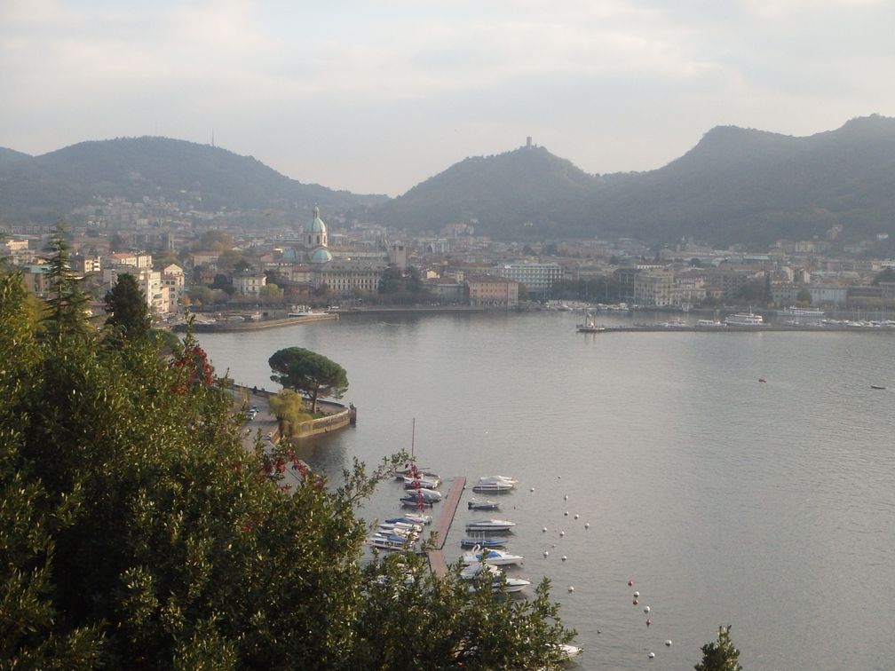
At the end of the descent, I was back at the lake, on the shore between Bellagio and Como. This road is nice, overlooking the lake with little ups and downs, and much less traffic than I had feared. From Como to Cernobbio it was much busier until I reach the Monte Bisbino road. Beautiful views of the lake and the city of Como are offered at the beginning of the climb, and unlike all of the other BIG of the region, Monte Bisbino is reasonably steep, so it was a nice climb. I headed then to Switzerland and Mendrisio, where I stopped for the night, at the foot of Monte Generoso.
Monte Generoso climb begins in a very steep street of Mendrisio, calms down when crossing some houses, then climbs steadily to the finish. There is a train going up the mountain but not functioning as I was there as a new hotel at the top was being built. The road ends at a stop called Stazione Bellavista, but I was not able to confirm that, as a thick fog surrounded me, and I unfortunately saw nothing of the supposed nice views over Lago di Lugano.
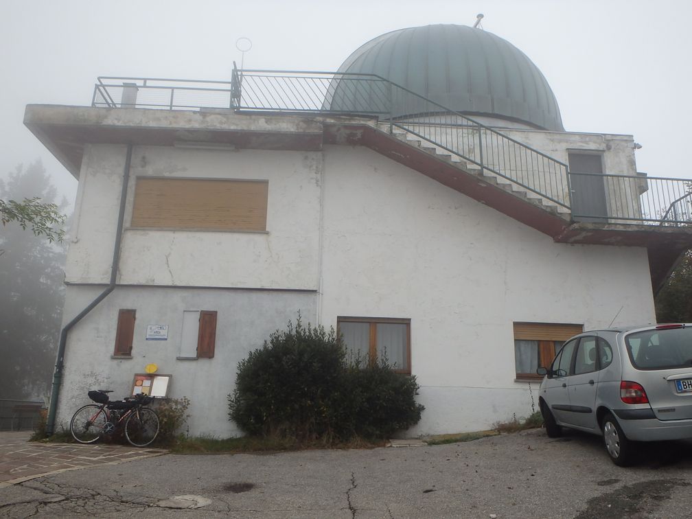
Down in Mendrisio, I turned towards Varese and entered Italy again. I passed along the north of Varese, and some very small roads around Olona, to go to my next BIG, Campo dei Fiori. A huge building, which is in fact an abandoned hotel, can be seen on the top when climbing. But the BIG is set at the observatory nearby, on top of a very very steep ramp. When going down, I thought about go and see the hotel, but was not sure of the way as two roads leave the observatory road in two different hairpins, so I continued my descent directly.
After Campo dei Fiori, I took the direction of San Martino, which is also a dead-end road that leads to a solitary chapel. During the climb, and also at the top, I could enjoy nice views to the Valcuvia below. There were children plays, and also a restaurant up there, but on a week day at the end of October, everything was desert.

Down in Valcuvia, I had not a long ride to be at the foot of passo Cuvignone. In fact from this side, you climb north to passo Sant Antonio, where, instead of going down to lago Maggiore, you turn left to go to passo Cuvignone, which takes you back to Valcuvia again. It’s a steady climb all the way, and the descent towards Cittiglio appeared to me quite steep also.
I took once again a boat in Laveno to cross lago Maggiore, as the last two BIG, Alpe Rossombolmo and Mottarone, were on the Piemontese side. I stopped when I saw a hotel in Mergozzo, along a nice lake, just before Ornavasso, the foot of Alpe Rossombolmo. It was not very late when I arrived, so I was thinking of climbing Alpe Rossombolmo in the evening, after having set up in the hotel. But I feared this climb, and riding at night is nice in a way, but of course hides the scenery, which is the main motivation for this kind of trips. So when the man at the hotel locked my bike in his garage, I let him do without protesting.
The morning after, I headed towards Ornavasso under a generous sun. At the Santuario Della Madonna Del Boden I felt something strange about the road, and realized I should have turned right just before. After a few kilometers on a steep road, the asphalt began to deteriorate, and the road became so steep at a moment that I couldn’t no more stay on my bike. After a flat stretch in the forest, and another impossible to ride steep ramp, I arrived at a wooden arch that showed the beginning of the path to Alpe Cortevecchio. From this point, the road was all rideable, even if there were still very steep ramps, and I arrived finally at the top of the climb.

The road finishes abruptly a few hundred meters before what appears as the last house in this part of the mountain. From here you can see a little below the few houses of Alpe Cortevecchio, and in the distance Isola Madre in the middle of Lago Maggiore. I have read, but after my ride, that walking to the crest just over the road would have allowed me to discover wonderful views of the Ornavasso valley below.
After a cautious descent, I was on the highway towards Gravellona Toce and Omegna. At the south exit of Omegna, I took the Mottarone road. As this road climbs along the lago d’Orta, I expected nice views over the lake but it was hidden most of the time by a wall of trees. After Agrano and a little descent, I climbed to Armeno where I took a one-way street (it’s bad) to save me 20 m of elevation loss before reaching the last part of the Mottarone road.

This was the last BIG of this four-day trip, but it turned to be by far the most beautiful, and one of the most (if not the most) extraordinary climbs I’ve ever done. On the first hairpin over Armeno, I began to see a snowy peak (Monte Rosa) rising over the lower, forest-covered, mounts around me. As I climbed, more mountains were showing in every direction. On a stretch looking south, I was even happy to see the familiar figure of Monviso, at a distance of 170 km!
The road from Armeno joins the road from Stresa for the last stretch to a little ski resort. There the road performs a loop around the peak and a cemented, deteriorated and very steep ramp allows to reach the top of the mountain, where stands a big antenna.
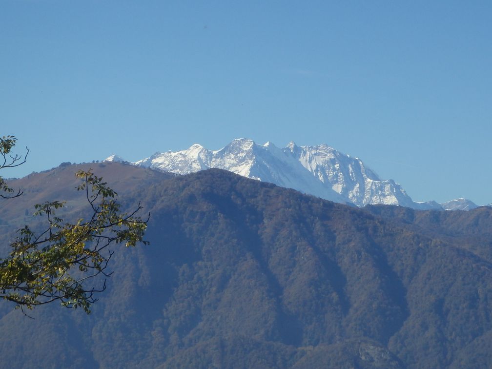
From here I enjoyed one of the most beautiful panoramas that can be found, with mountains everywhere: Monte Rosa, Breithorn, high peaks from Saastal, Bernina, and so on. Below could be seen all the lakes: Maggiore, Orta, Varese, Lugano … It was a splendor.
After a long stop and a lot of pictures taken, I started the descent towards Stresa. I passed a tollbooth that seemed strange here as the other road was free and arrived above Stresa, enjoying some last nice views over the town and the Borromee islands.

The trip was now finished and it was time to take the train back home. The Stresa line leads to Milano, where I was unlucky to miss a train to Genova for a few minutes. So I had to wait two hours for the next one that went to Albenga. I finally stopped in Genova, as I renounced to do the ride from Albenga to Nice from midnight to 3 am. When I found myself alone in my hotel room in Genova I thought I should have done it anyway, but never mind, the Sunday afternoon I was back in Nice to see my favorite team defeat 4 to 1 the FC Nantes, and with 12 more BIG in my musette.
Pictures : http://cathie.charbonnier.free.fr/piwigo/index.php?/category/7